Before developing any land, one question is very important that comes to the mind and that is
What is really happening beneath the surface?
And in appearance, as we view the outside, the place might seem clean and steady, but when you begin it digging or drilling it, it usually works out quite differently. E.g., the polluted soil, waste concealed in the soil, or polluted groundwater might be present, but they cannot be noticed on the surface. Before land purchase, redevelopment or construction, it therefore becomes significant to have a deep site assessment.
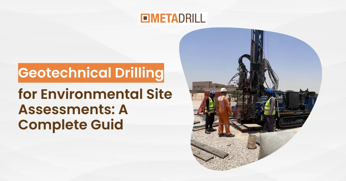
These evaluations assist in determining the risks that can pose any threat to human health, project safety, or land use in the long run. This is the stage at which it becomes practical. Surface inspection and reports can merely tell half of the story. Teams use geotechnical drilling to know what is beneath the ground.
Drilling enables engineers to take real samples of soil and groundwater, and this provides an accurate picture of the conditions at the sites. Decisions are made without dwelling on assumptions. Drilling makes decisions that are grounded on real-life information. This is the reason why geotechnical drilling in the environmental site assessment is so crucial. It assists in identification of contamination, analyzing the soil, and providing safe development on the first stage. Environmental Site Assessment (ESA) What is it? The drilling rigs manufacturers attempt to know the site by not touching the ground before any drilling is done. This is referred to as an environmental site assessment, or ESA.
What Is Environmental Site Assessment (ESA)?
Teams also attempt to know the site prior to touching the ground before the actual drilling begins. This is referred to as an environmental site assessment, or ESA. An ESA proves to answer a simple question.
Is the land safe in use, or does it have a concealed risk to the environment?
The process tends to take place in stages to respond to this. The first one is what is referred to as Phase 1 ESA. There is no drilling at this stage. Rather, the team examines site history, old records, maps and past land use. They also go to the area and search to see indications such as the presence of fuel stores, dumping or industry.
In some cases, such a step alone is informative enough. However, in most instances, it brings about new questions. As an illustration, in case the site appeared to have a fuel station or industrial activity, there is a possibility that contamination might exist underground. Surface checks at this stage are not sufficient anymore. This results in the second step, which is Phase 2 ESA. At this point the strategy is more feasible.
The team does not use documents and instead collects actual samples on the ground. This involves soil samples and samples of groundwater at various levels. This is purely where geotechnical drilling comes in. Drilling enables the team to pass underneath the surface and examine things that are inaccessible. In the absence of this step, pollution may be concealed, and it may result in grave consequences later in construction or land use. So in simple terms:
Phase 1 tells you what might be wrong
Phase 2 confirms what is actually there
Because of this connection, environmental site assessments and drilling always work together. One identifies the risk, and the other proves it with real data.
Role of Geotechnical Drilling in Environmental Site Assessments
Once Phase 1 raises concerns, the whole process shifts in one direction.
The team needs real proof from the ground.
This is where geotechnical drilling becomes the turning point.
Up to this stage, most decisions depend on records, site history, and surface observations. These give clues, but they don’t confirm what actually exists below. So instead of guessing, the team moves to drilling.
Drilling allows engineers to go below the surface and collect actual soil and groundwater samples. These samples show what is really happening underground, not what is assumed.
As drilling begins, each borehole reveals something new.
At one depth, the soil may appear clean. A few meters below, contamination may show up. In some cases, groundwater carries pollutants that move across the site without any visible sign on the surface.
Because of this, drilling changes the entire direction of the assessment.
What started as a possibility now becomes measurable data.
This data then connects directly to decision-making.
Engineers identify whether contamination exists
They measure how deep it goes
They understand how far it has spread
They decide what action is required
Without drilling, these decisions would remain uncertain. With drilling, the team works with clear evidence.
The other significant aspect is accuracy. Environmental hazards do not always remain at the same location. Pollution could travel in underground layers of soil or ground waters. The drilling of various points and different depths enables the engineers to create the complete picture of the site rather than just one point.
In the real world, therefore, geotechnical drilling is not a simple process of collecting samples. It relates research to action. It makes doubt into assurance.
And above all it assists teams in the decision-making process before the project becomes at a point where errors turn out to be costly.
The real revelation of Geotechnical Drilling.
As soon as the drilling begins the actual picture of the site starts to form. On the surface things appear to be normal but, on the ground, they are quite different.
This is where speculations cease and actual knowledge starts. The deeper the drill the story behind the layer is. The color of soils alters, the texture also changes, there is a change in the amount of moisture and occasionally, unforeseen materials are also present. All this provides hints regarding the past activity on the site. But drilling is not just a way to demonstrate layers.
It reveals three critical things that directly affect environmental decisions.
1. Hidden Soil Contamination
Conducting environmental drilling to detect contamination is one of the primary motivations of forming teams. The pollution of the soil is not always observable. A site might appear to be clean yet underground, fuel, chemicals or industrial waste can be trapped. Crews take samples of soil using drilling at various depths. These samples are sent to the lab, and specialists test them on the presence of harmful substances. In most scenarios, contamination manifests itself only at specific depths, hence making drilling important. In its absence, the problem may go undetected by teams.
2. Groundwater Conditions/ Pollution
When drilling becomes deeper, it usually crosses groundwater. This is significant as ground water may be contaminated to other sources other than the source. A minor problem in one location can be propagated by the water flow in a bigger region. Through sample ground water, the engineers are able to:
By collecting groundwater samples, engineers can:
detect pollutants in water
understand how contamination is spreading
evaluate risks to nearby areas
This step becomes critical when the site lies near residential zones, water sources, or agricultural land.
3. Soil Layers and Subsurface Structure
Drilling also reveals how the ground is built below the surface.
Different soil layers behave differently. Some layers support structures well, while others create instability. In environmental assessments, this information helps understand how contamination moves and where it may settle.
For example:
sandy soil may allow faster movement of pollutants
clay layers may trap contamination in one place
fractured zones may create unexpected pathways
Because of this, soil layering becomes a key part of the analysis.
When all these findings come together, the site starts to make sense.
Instead of working with assumptions, engineers now understand:
where the problem exists
how serious it is
what needs to be done next
That is why drilling becomes the most revealing part of the entire environmental assessment process.
How Geotechnical Drilling Works for Environmental Site Assessment
After the site goes into Phase 2 assessment, the activity is no longer observation but action. At this stage, the team ceases to be dependent on the reports or assumptions. They begin to gather actual facts on the ground. This is a linear process with every step having a linkage to the other.
This process follows a clear sequence, and each step connects to the next.
Step 1: Select Drilling Locations
The team does not drill randomly. Instead, they choose locations based on earlier findings from Phase 1.
If a certain area shows signs of past industrial use or possible contamination, that spot becomes a priority. In some cases, multiple points are selected to understand how conditions vary across the site.
This step ensures that drilling targets the areas that matter most.
Is the site safe for construction?
Does contamination require cleanup?
Are there risks to nearby areas?
These answers guide the next steps of the project.
When you look at the full process, one thing becomes clear.
Drilling is not just about creating holes in the ground. It is about uncovering what the surface hides and turning that information into decisions that affect safety, cost, and project success.
Types of Samples Collected in Environmental Drilling
Once drilling begins, the main goal becomes clear.
The team needs reliable samples from below the surface so they can understand what is actually present in the ground. These samples are not random. Each one is taken carefully because it represents a specific depth and condition.
As the process continues, three main types of samples are collected, and each one adds a different piece to the overall picture.
1. Soil Samples
Soil sampling usually starts as soon as drilling begins.
As the drill moves through different layers, the crew collects soil at selected depths. Each sample shows how the soil changes as you go deeper. Sometimes the difference is obvious. Color, texture, and moisture levels can shift within a short distance.
These samples are important because contamination often hides within specific layers.
For example:
fuel residues may appear in one layer but not in another
industrial waste may settle deeper below the surface
some pollutants remain trapped in clay layers
Because of this, sampling at multiple depths helps avoid missing critical information.
2. Groundwater Samples
Drilling then commenced after the locations are marked. The rig drills boreholes to reach the depths of the critical layers of soil and groundwater. The depth needed varies according to the project, although the objective is the same. The team would like to have an overview of what is going on under the carpet, not around it. The deeper the borehole is the more the driller will notice the change in soil conditions and document them.
This makes groundwater testing especially important when:
the site lies near residential areas
there are nearby water sources
long-term environmental impact is a concern
By analyzing groundwater, engineers can track how contamination moves and how far it may extend.
3. Core Samples (When Required)
In some cases, especially in harder formations, the team collects core samples.
These samples come out as solid cylindrical sections of the ground. Unlike loose soil samples, cores show the structure of the ground more clearly.
Core samples help when the team needs:
a detailed view of soil or rock layers
better understanding of how materials are arranged
more accurate analysis in complex ground conditions
They also help confirm findings from other samples and provide additional clarity.
When all these samples come together, they create a complete picture of the site.
Instead of looking at isolated data, engineers start seeing connections between soil layers, groundwater movement, and contamination patterns.
This combined understanding helps them move forward with confidence.
Drilling Methods Used in Environmental Site Assessments
Once the team decides where to drill, the next question usually comes up on site.
“Which drilling method should we use here?”
There is no single answer, because every site behaves differently. Ground conditions, project goals, and required sample depth all influence this decision.
Because of this, teams choose the method that fits the situation instead of forcing one approach everywhere.
1. Auger Drilling
Auger drilling is one of the most commonly used methods, especially for shallow investigations.
The process looks straightforward. A rotating auger cuts into the soil and brings it up to the surface as drilling continues.
This method works well in softer ground where the soil holds together easily. It allows crews to collect samples quickly without complex setup.
However, once the ground becomes harder or starts collapsing, auger drilling becomes less reliable. At that point, the team usually switches to another method.
2. Rotary Drilling
When the ground becomes tougher or the project requires deeper investigation, crews often move to rotary drilling.
This method uses a rotating drill bit along with drilling fluid. The fluid helps cool the bit and carry cuttings back to the surface.
Rotary drilling works well in a wide range of conditions, from soft soil to harder formations. It also allows the team to go deeper compared to simpler methods.
Because of this flexibility, many environmental projects rely on rotary drilling when conditions become more demanding.
3. Direct Push Method
In some situations, especially when the goal is quick sampling, teams use the direct push method.
Instead of drilling in the traditional way, this method pushes tools directly into the ground using hydraulic force.
It works best in soft to medium soils where resistance stays manageable. The process is fast, and it creates minimal disturbance to the surrounding area.
Because of this, it is often used for environmental investigations where speed and efficiency matter.
When you look at these methods together, one thing becomes clear.
There is no “best” method for every project.
The right approach depends on:
ground conditions
required depth
type of samples needed
That is why experienced teams stay flexible. They adjust their method as conditions change instead of sticking to one approach.
Common Challenges in Environmental Drilling
Once drilling begins, things rarely go exactly as planned. On paper, the process looks straightforward. But on site, ground conditions, contamination behavior, and sampling accuracy can create real challenges.
Because of this, experienced teams stay alert from the start.
1. Contamination Spread During Drilling
One of the biggest concerns is spreading contamination while drilling.
As the drill moves through different layers, it can carry pollutants from one level to another. This process, often called cross-contamination, can affect the accuracy of results.
For example, if contaminated soil from an upper layer moves downward, it may give a false impression that deeper layers are also polluted.
To avoid this, crews follow strict procedures:
clean tools between samples
control drilling speed
use proper casing when required
These steps help maintain sample integrity.
2. Unstable Ground Conditions
Not every site behaves the same way.
In some areas, soil holds its shape well. In others, especially in loose or wet conditions, borehole walls may collapse during drilling.
When this happens, it creates two problems at once.
First, drilling becomes difficult. Second, the collected sample may not represent the actual soil layer properly.
To manage this, teams adjust their drilling method or use casing to support the borehole.
3. Difficulty in Accurate Sampling
Collecting a sample is easy. Collecting the right sample from the right depth is where the real challenge lies.
If samples mix during extraction or get disturbed, the lab results may not reflect true site conditions.
Because of this, crews pay close attention to:
labeling samples correctly
maintaining depth accuracy
handling samples carefully
Even small mistakes at this stage can affect the entire assessment.
4. Groundwater Control Issues
When drilling reaches groundwater, things become more sensitive.
Water flow can disturb soil layers and affect sampling. At the same time, contamination may move through water, which makes it harder to track its original source.
To handle this, teams often install monitoring wells and take controlled samples instead of rushing the process.
5. Access and Site Limitations
Not all sites are easy to work on.
Some locations have limited space, nearby structures, or restricted access. In such cases, bringing large rigs or setting up equipment becomes difficult.
Because of this, teams sometimes need to adjust equipment size or drilling method to fit the site conditions.
When you look at these challenges together, one thing becomes clear.
Environmental drilling is not just about technique. It requires awareness, control, and careful handling at every step.
You can also check: 7 Mistakes Companies Make When Buying Drilling Rigs
Why Geotechnical Drilling Matters for Real Projects
At this point, everything comes together.
Environmental site assessment may start with reports and site history, but it does not become reliable until drilling begins. Without drilling, teams work with assumptions. With drilling, they work with actual conditions from the ground.
This difference changes how decisions are made.
When drilling reveals clean soil and stable groundwater, the project can move forward with confidence. On the other hand, if contamination appears, the team can respond early instead of dealing with problems during construction.
This early clarity saves both time and cost.
For example, imagine starting construction without proper investigation. If contamination shows up later, work may stop completely. Cleanup, redesign, and delays can quickly increase project expenses.
Now compare that with a site where drilling happens at the right stage.
The team already knows:
where contamination exists
how deep it goes
whether it spreads through groundwater
Because of this, they plan ahead instead of reacting later.
This is where geotechnical drilling proves its real value.
It does not just support environmental assessment. It protects the entire project from uncertainty.
So if you are planning land development, construction, or site purchase, one thing becomes clear.
Skipping proper drilling is not a risk worth taking.
Even if everything looks fine on the surface, the real condition always lies below. And the only way to understand it properly is to test it.
In the end, the decision becomes simple.
If you want assumptions, you rely on surface checks
If you want certainty, you rely on drilling
And in projects where safety, cost, and long-term performance matter, certainty always wins.
Question to the public:
Learn how geotechnical drilling supports environmental site assessments. Understand soil testing, groundwater sampling, and real site investigation methods.